Palm Springs subcommittee tackles bike safety, wayfinding, CV Link gaps and a long-range downtown vision
From downtown wayfinding to a proposed bidirectional bike lane, the subcommittee covered a wide range of issues related to cyclist and pedestrian safety.
The Palm Springs Sustainability Commission’s Standing Subcommittee on Active Transportation met Monday to review progress on several street improvement projects, identify gaps in connections to the CV Link regional trail, and begin an early discussion about bringing protected bike infrastructure to the city’s downtown core.
Paving and striping work on Sunny Dunes Road is nearly finished, “I want to say it was 95% done,” Anthony Acosta, a city senior civil engineer said.
Local reporting and journalism you can count on.
Subscribe to The Palm Springs Post
The remaining work involves signage, including new speed limit signs dropping the posted limit from 35 to 30 mph. Staff also said they plan to add shared-lane markings — known as sharrows — along South Camino Real leading toward the CV Link, along with wayfinding signs directing cyclists from Camino Real down to the regional trail at North Riverside Drive.
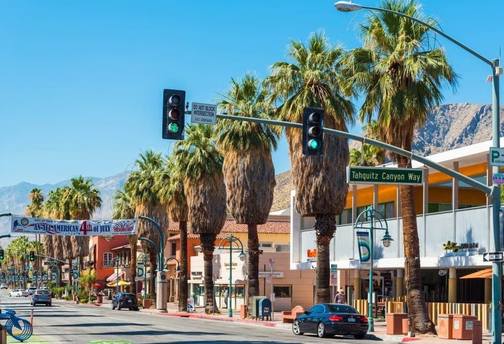
On South Palm Canyon Drive, engineers have settled on a wayfinding signage approach to guide cyclists from the end of the existing bike lane to Belardo Road after safer but more complex design options were rejected.
A subcommittee member raised concerns that the current design leaves tourists, who may be unfamiliar with the area, in a potentially unsafe position.
“We want this to be a Vision Zero city,” one subcommittee member said, referring to the idea that cities should work to bring the number of traffic-related deaths and serious injury to zero. “But there’s no vision here. We’re putting tourists in a really dangerous place.”
The rejected design idea included a separate parallel bike lane, green-painted crossings, and a curb cut through the island separating bike traffic. City consultants found issues with the plan that violated California Manual on Uniform Traffic Control Devices (MUTCD)
Consultants suggested the more cost-effective option of a simple sign, but subcommittee members worried the sign directing riders onto Belardo was still too unclear, and would lead cyclists to moving with car traffic rather than walking their bike across the crosswalk as intended.
“One of the things that this plan does is — instead of making it safer for bicycles and pedestrians — it catapults everybody into the line of traffic,” another subcommittee member said.
The subcommittee asked city staff to obtain the specific sections of the state’s MUTCD that prevented more protective design options at the intersection, and members said they would provide photographs of comparable treatments from San Francisco and Portland for staff to review.
Acosta told the subcommittee that a more protective option should be a longer-term goal, but for now the wayfinding will work as an interim solution.
On the CV Link, a subcommittee member presented a map of locations where neighborhoods lack a direct connection to the regional trail, identifying several priority gaps including an unconnected path near the Tramview area, a missing link serving the Desert Highland Gateway Estates neighborhood, and a location near the Gene Autry Trail bridge where a protected bike lane runs within 15 feet of the CV Link with a fence in between and no opening.
At North Riverside Drive, city staff said a relatively low-cost fix is being pursued — a concrete pad and curb cut that would give cyclists a proper exit from the CV Link path onto the street, along with sharrows on North Riverside to direct bicycle traffic and a stop sign to prompt cyclists to check for traffic before entering the roadway.
The subcommittee also opened a discussion about a longer-range concept: a bidirectional protected bike lane running along either Palm Canyon Drive or Belardo Road from Alejo Road to Ramon Road through the downtown core.
A subcommittee member who said he had worked on a similar proposal while serving on the sustainability commission in 2022 argued that removing one southbound lane from Palm Canyon Drive would still leave more southbound capacity than northbound lanes following the redesign of Indian Canyon Drive.
“I’ve looked at a number of other cities that have taken two way bike lanes and put them on a one way street,” the subcommittee member said. “When I was living in Honolulu, they did it. I’ve seen it in Portland a couple of places. And it is doable.”
Another subcommittee member said the group should begin planning for both interim safety improvements and a longer-term vision for slowing traffic through the downtown corridor on Palm Canyon Drive and Indian Canyon Drive.
“The long term items about how to decrease the speed of traffic going through the downtown, both on Palm Canyon as well as on Indian and so to then how to incorporate bicycles and pedestrians into that in a really cohesive way — that may be a 5, 10, 20 year plan,” the member said.
Assistant City Manager Flinn Fagg said the city is moving toward accepting a grant that would fund a request for proposals for a consultant to update the city’s pedestrian plan, and that the Active Transportation subcommittee would be included as a stakeholder group in that process.
The subcommittee’s next meeting is scheduled for June 8 at 1 p.m.
Author

Related Articles
Commission hears update on plan that aims to map and fix the worst shade gaps across Palm Springs
Consultants are tracking down which neighborhood parks, school routes, and transit stops are leaving vulnerable residents exposed so the city can prioritize where to build cooling infrastructure next.
Palm Springs moves forward with road safety study, fresh fixes for CV Link
From sorting out cyclist-pedestrian confusion on the CV Link to a deep-dive safety study on major corridors, city leaders are mapping out immediate and long-term fixes to make streets safer.

Committee will start reevaluation of city’s climate goals
Sustainability Commission members will review a five-year-old document ahead of a 2027 update, with officials signaling some goals may need to be revised.